Bukit Kiara is a small, low-lying hill that runs on a north-south axis, from Kepong in the north to Taman Rimba Kiara in the south. Bukit Sri Bintang, another popular hiking destination is essentially the northern spur of the Kiara hill (though fragmented following the construction of the North-South Expressway).
The western flank of Bukit Kiara overlooks the township of Taman Tun Dr. Ismail and Kampung Sungai Penchala whereas to the east, its foothills meet Kampung Segambut Dalam, Mont Kiara and Sri Hartamas.
A highway, the Penchala Link passes through the middle of the hill. Fortunately, the highway developers managed to keep Bukit Kiara intact, by building a 700-metre-long tunnel through the foot of the hill — a great example of how engineering solutions can be employed to prevent forest fragmentation.

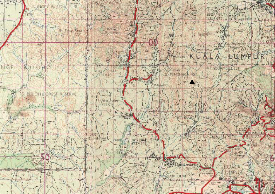
Map source: Director of National Mapping, Malaysia
The hill’s highest elevation is given as 865 ft (264 m) above sea level in old topographic maps, and slightly higher at 270 m on OpenStreetMap.
More importantly, however, it forms the catchment of three tributaries of the Klang river (the headwaters of Sungai Penchala originate from its southern sections, while some tributaries of Sungai Kayu Ara and Sungai Teba (a branch of Sg. Kroh) originate from its north-western and north-eastern sectors respectively.
The southern half of the hill, including the adjacent flatlands towards the southeast was formerly occupied by the Bukit Kiara Rubber Estate that was established by a British planting syndicate at around the beginning of the 20th century and subsequently bought over by a local company, Ng Chin Siu & Sons.
The Bukit Kiara Federal Park (Taman Persekutuan Bukit Kiara) is located within the north-western quadrant of that former estate.

